DISPLAY BOARD ⑥ DUMBROCK
(This is a copy of the information on the Heritage Trail display board.)
WATER WATER EVERYWHERE
“Strathblane abounds in lochs, nearly 150 acres of its surface being covered with water.” John Guthrie Smith, ‘The Parish of Strathblane’ (1886)
Guthrie Smith recorded the largest local loch as Loch Ardinning, followed by Lochs Craigallian, Mugdock, Dumbrock, Carbeth and Craigmaddie, as well as the Deil’s Craig and two other smaller mill dams. This abundance of water made Strathblane, particularly the Dumbrock area, a natural location for watermills and bleachfields.
MILNDAVIE MILL

At the top of the area of Dumbrock known as the Glen lies Milndavie Mill. Its history dates back to 1657, when tenants from a wide area were obliged to use it to grind their oats.
Legend has it that corn was once cut, threshed, ground, baked and eaten, all within 24 hours. The tale claims the miller was helped by witches who had been entertained by the Devil. Hence the name of one of the dams that fed the mill: Deil’s Craig.

John Smith of Craigend, whose family made a vast fortune from slavery, mainly from the West Indian sugar trade, bought Dumbrock and Milndavie Mill shortly before his death in 1816. His son James, noted for his “zeal for improvements”, upgraded the mill and added to the storage capacity of the mill dams by raising the embankments at Dumbrock Loch (known locally as Ebie’s or Abie’s), Deil’s Craig and Loch Ardinning. This ensured a steady supply of water, controlled by sluices.
By 1870 the mill was operating as a saw mill, as well as a meal mill but by 1900 it had closed. It has since been used as a store then converted into housing.
THE FLOCK MILL
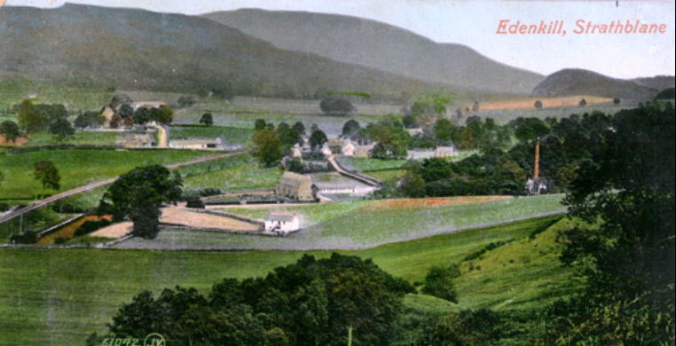
Around 1874 further down the Glen, David Hamilton started a “flock” (rag) mill where cloth was shredded to make mattress stuffing. Though it ceased trading soon after 1900, it gave its name to the adjacent burn: the Raggie Burn. Presumably small shreds of material often ended up in the water. A vintage postcard features the flock mill’s tall chimney.
THE BLEACHFIELDS

In the late 1700s there were four recorded bleachfields in the parish where cloth was soaked and spread on the ground to bleach in sunlight. This was an important part of textile manufacture during the Industrial Revolution. Later, chemicals were introduced to shorten the time taken. The Dumbrock bleachfield was the oldest in Strathblane and the one that lasted longest.
It specialised in pieces of cloth known as “native webs”. The 1860 Ordnance Survey map shows a large soaking pond on what is now the football field. The Dumbrock operation closed around that time, after chemical-based processing made bleachfields redundant. Part of the area is now occupied by the Wildlife Sanctuary.

DUMBROCK WORKS & KING GEORGE’S FIELD
Following the closure of the bleachfield, a printworks was built on part of the site but never completed. It was only ever used for storage and accommodating some of the mainly Irish labourers building the Second Aqueduct in the early 1890s. The Dumbrock Works was demolished in 1905 and many of the bricks were used in the construction of three double villas opposite the Edmonstone Hall.
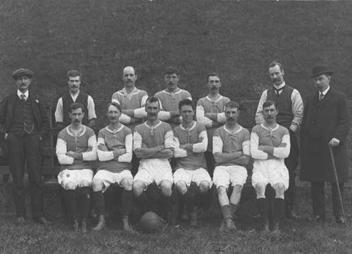
Shortly afterwards the area became the local football field. Though the community had boasted a football team since 1876, it had struggled without a home ground. Following the death of King George V in 1936, it was one of 471 UK playing fields to benefit from capital grants given in his name. Since then it has been known as “King George’s Field” and is the home ground of Blanefield Thistle FC. Following the closure of the Blane Valley Railway in 1959, the railway embankment bordering the touchline was demolished and the soil used to raise the level of the pitch.
HERITAGE TRAIL MAP