The trail consists of seven readily accessible sites covering different aspects of our rich local history.
The circuit is two miles in length on pavements and paths and makes an easy, pleasant walk 60 to 90 minutes.
Strathblane is renowned for its tranquil beauty, though the Campsie Hills that tower over it bear the marks of pre-historic volcanoes. There are several ancient standing stones in the area, including one in this churchyard. For 300 years, the area lay on the northern fringe of the Roman Empire and was then fought over by Picts, Scots, Saxons and Vikings before becoming part of the Earldom of Lennox in the 12th Century.
The parish was predominantly agricultural, taking in the three villages of Mugdock, Edenkiln [Strathblane] and Netherton [Blanefield] until the 19th Century when the Blanefield Printing Company employed hundreds of men, women and children at its calico printworks. The arrival of the Blane Valley Railway in 1867 and of better roads helped to link the community to the world beyond its horizons.
In the 20th Century, following the closure of the printworks in 1898, the area became popular with day trippers and holidaymakers, drawn by the area’s outstanding beauty and rural atmosphere so close to Glasgow.
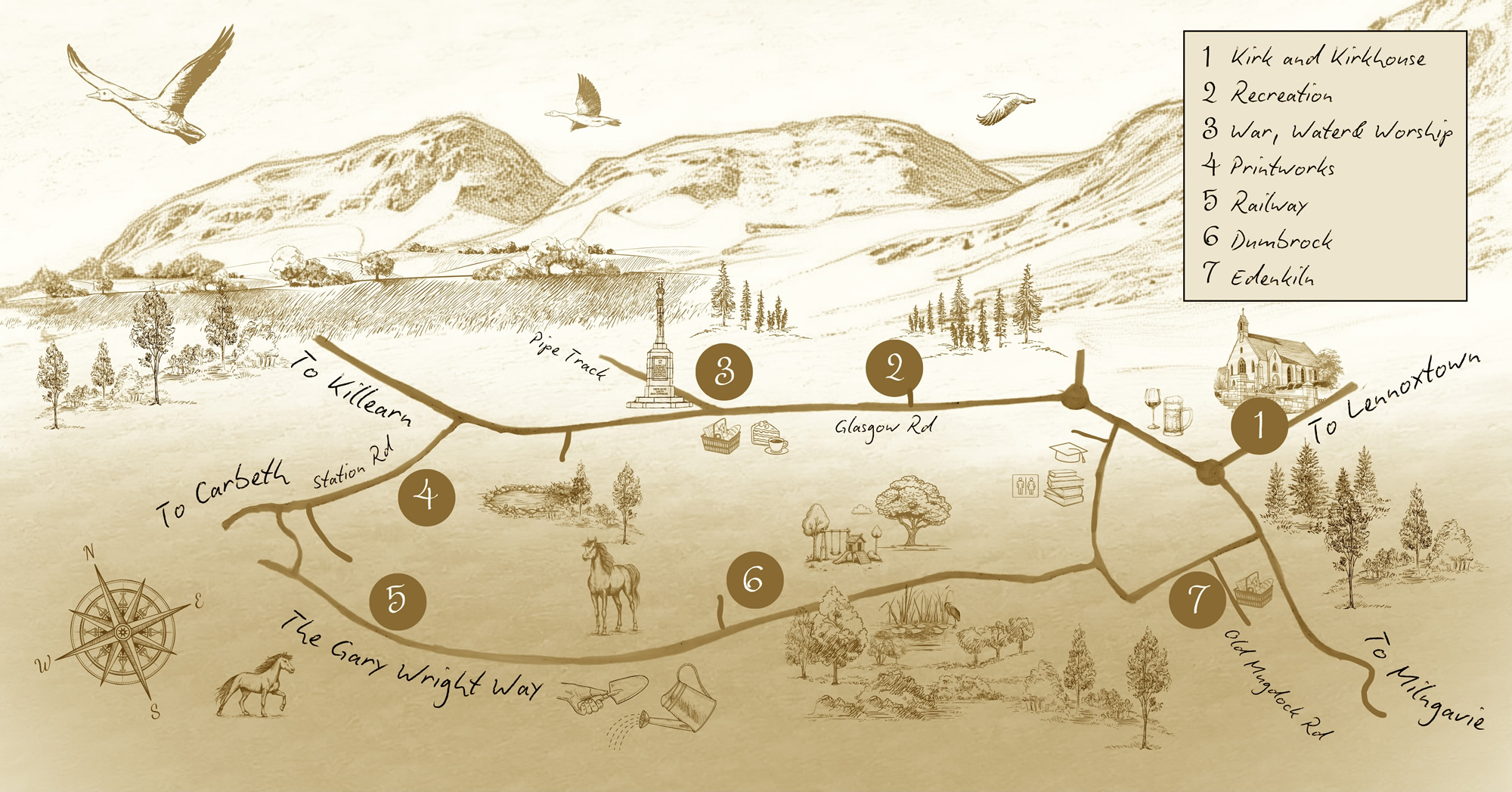
HERITAGE TRAIL MAP