The drafts of the boards that will go up around the community have now been prepared and are out for consultation. A3 size versions are currently on display at the Thomas Graham Community Library in Strathblane. Proofs have also been sent to individuals and organisations mentioned on the boards. Comments and suggestions are invited. The final boards will be around 33ins wide and 24.5ins deep. The route has been designed to incorporate the existing board on the Gary Wright Way about the Blane Valley Railway. This was commisioned and installed by Strathblane Community Development Trust in 2021.
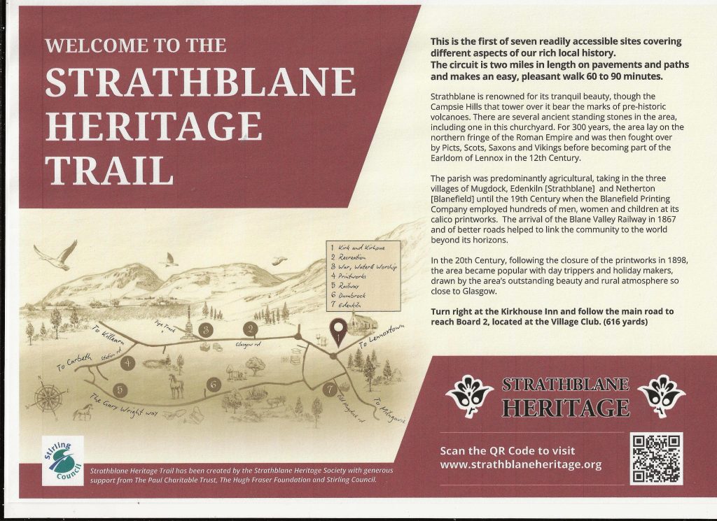
There are seven new boards, including the “Welcome Board”, pictured above. Text and colours may vary slightly. They will be built out of powder-coated aluminium finished to enamel to protect them against rust, decay and vandalism. They are guaranteed to have a minimum life of ten years.
Kenwil Ltd of Kirkintilloch has been selected to produce the new boards. They will resemble those the company has installed in Mugdock Country Park.
Strathblane artist Amy Ricketts was engaged to produce the route map, which will appear at each location. We’re really pleased with the result.
Each board carries a QR code, linking visitors to www.strathblaneheritage.org where more detailed information can be accessed.
Local photographer Jamie Ballantine will produce drone footage of the route, also linked to the website. So anyone anywhere in the world will be able to enjoy the trail digitally!
The text has been written by Anne Balfour. Stephen Thomson of Kenwil has designed them. A team led by Keith Vass has kindly agreed to install the signs.
Children from Strathblane Primary School will help us launch the trail. And a family quiz, based on the trail, is also planned.
The locations for the boards are:
- Strathblane Parish Church. (There will also be a Welcome board here.)
- Village Club
- War Memorial
- Station Road (junction with Blane Avenue)
- (The existing board about the Blane Valley Railway on the Gary Wright Way)
- Dumbrock (corner of Wildlife Sanctuary)
- Edenkiln (junction of Dumbrock Rd and Old Mugdock Rd)
The route is two miles in length and takes between 60 and 90 minutes to walk. There will be a free leaflet, explaining the trail and offering information about transport, parking and local hospitality.
Last year we were able to secure funding for this project, thanks to the generosity of the Paul Charitable Trust, the Hugh Fraser Foundation and Stirling Council. The balance will come from Strathblane Heritage funds.
Drafts will be on display at the library until the end of February.